Kongu city, Western Ghats and enterprising plains
Coimbatore District: Kongu Culture, Nature and Places to Explore
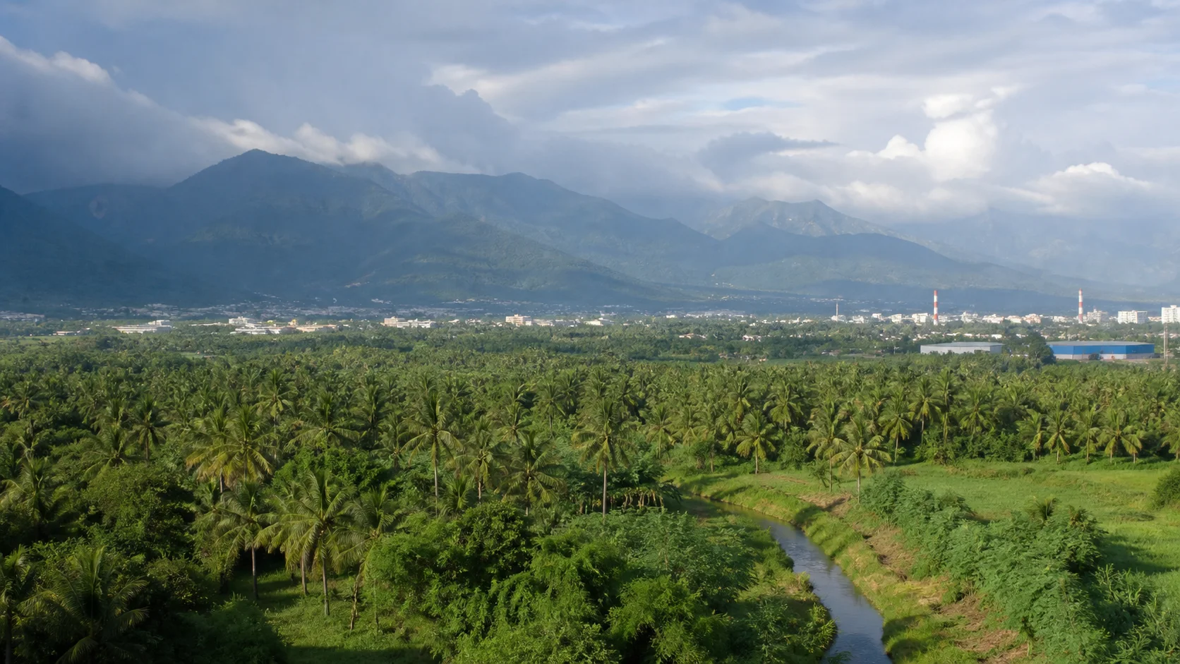
Coimbatore district joins one of Tamil Nadu's largest urban and industrial centres to agricultural plains, the Palakkad Gap, Western Ghats foothills, the Anaimalai landscape, plantation settlements and market towns. The district is often used as a gateway, but its own relationships among city, water, work, food and mountain ecology deserve careful exploration.On this page
District overview
Understanding Coimbatore district
This guide uses current Coimbatore district boundaries and revenue divisions.[coimbatoreAdmin]
Pollachi, Anaimalai and Valparai are within modern Coimbatore district; Tiruppur and Erode are separate districts despite strong historical and economic connections.
The Western Ghats are a large ecological system extending far beyond the district, so Coimbatore cannot claim every nearby hill station, reserve or waterfall as a district place.
Why it matters
Why explore Coimbatore?
Coimbatore city demonstrates how textiles, engineering, entrepreneurship, education and migration shaped a major inland urban centre.[coimbatoreAbout][coimbatoreHistory]
Pollachi and surrounding plains connect coconut-based agriculture, markets, cinema imagery and routes toward Anaimalai.
Valparai's plantation plateau sits within a sensitive mountain and forest landscape where roads are wildlife corridors as well as visitor routes.
Mettupalayam links plains, river context and the Nilgiris gateway without becoming part of The Nilgiris district.
Land and water
Geography and regional identity
The district lies between the Western Ghats and eastern plains, with the Palakkad Gap influencing wind, transport and regional connections.
The Noyyal basin is important to Coimbatore's settlement and water history, while the Bhavani system relates to the Mettupalayam side.
The Anaimalai foothills rise south of Pollachi toward Valparai's higher, wetter plantation landscape.
City weather, Pollachi wind, foothill rain and Valparai mist can differ sharply. Use current IMD forecasts and road advisories rather than one district label.[imd][warnings]
Forest roads and hill areas are habitat, not scenic corridors with guaranteed wildlife or unrestricted stopping.
Evidence and change
Historical overview
The district administration places Coimbatore within the historical Kongu region and records phases associated with early Tamil polities, medieval dynasties, Mysore and British rule.[coimbatoreHistory]
Local history includes trade routes through the Palakkad Gap, agriculture and settlement around rivers and tanks.
Colonial and twentieth-century textile growth developed alongside foundries, pumps, engineering and later diversified manufacturing and services.
Modern boundary history matters: Erode district separated from the former Coimbatore district, and Tiruppur district was later created from parts of Coimbatore and Erode.[coimbatoreHistory]
Present-day industrial identity should be read together with labour, water, environmental change and rural enterprise.
Continue with Tamil Nadu history →Within the district
Cities, towns and local centres
These are district contexts, not newly created destination pages.Coimbatore / Kovai
Administration, industry, education, healthcare, markets and transport anchor the district.
Pollachi
Coconut landscapes, trade and routes toward Anaimalai shape a strong identity.
Mettupalayam
A plains town linked to the Bhavani, agriculture and Nilgiris transport.
Valparai
Tea estates, forest mosaics and difficult mountain roads require condition-led planning.
Annur
Agriculture, small industry and transport connect rural and urban economies.
Sulur
Agriculture, industry, aviation-linked institutions and expanding settlement overlap.
Living and protected places
Temples and spiritual places
Perur Patteeswarar Temple
A major living Shaiva temple west of the city; worship and official rules lead access.
Marudamalai Murugan Temple
A hill temple near Coimbatore; road, crowd and wildlife-edge conditions can change.
Eachanari Vinayagar Temple
A living urban-edge temple on a busy road corridor.
Masani Amman Temple, Anaimalai
A major living goddess institution in the Pollachi-Anaimalai part of the district.
Isha-area institutions
Contemporary religious sites require their own official access and event information; no endorsement is implied.
Interpret carefully
Heritage and architecture
Kongu regional history
Language, agriculture, trade, worship and political history connect Coimbatore with a wider region, not one administrative unit.
Industrial heritage
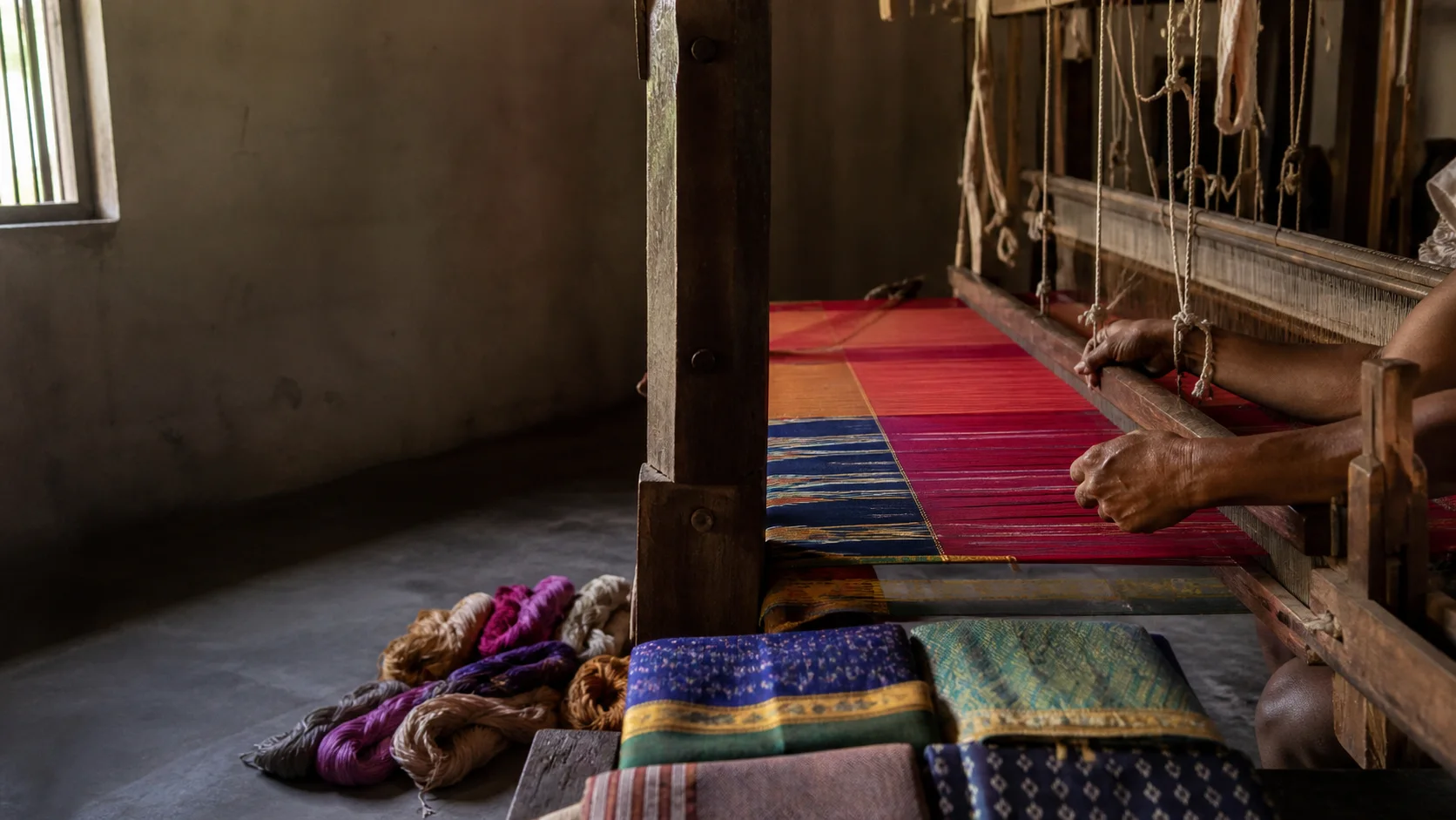
Mills, engineering workshops and maker networks are part of modern history, usually on working private premises.
Gass Forest Museum context
A historic forestry institution; current public access must be checked through the responsible authority.
Mountain plantation landscape
Valparai's built and cultivated environment exists within older forest and wildlife systems.
Living knowledge
Culture, food and regional products
Culture and festivals
Kongu Tamil, rural festivals, temple traditions, urban arts, colleges and industrial work all contribute to district culture.
Migration from across Tamil Nadu and India has shaped Coimbatore city's neighbourhoods, workplaces and food.
Pollachi's media image as an endlessly green rural setting should not replace the realities of water, labour, land ownership and seasonal change.
Festival dates, processions and public events require current official verification.
Food and cuisine
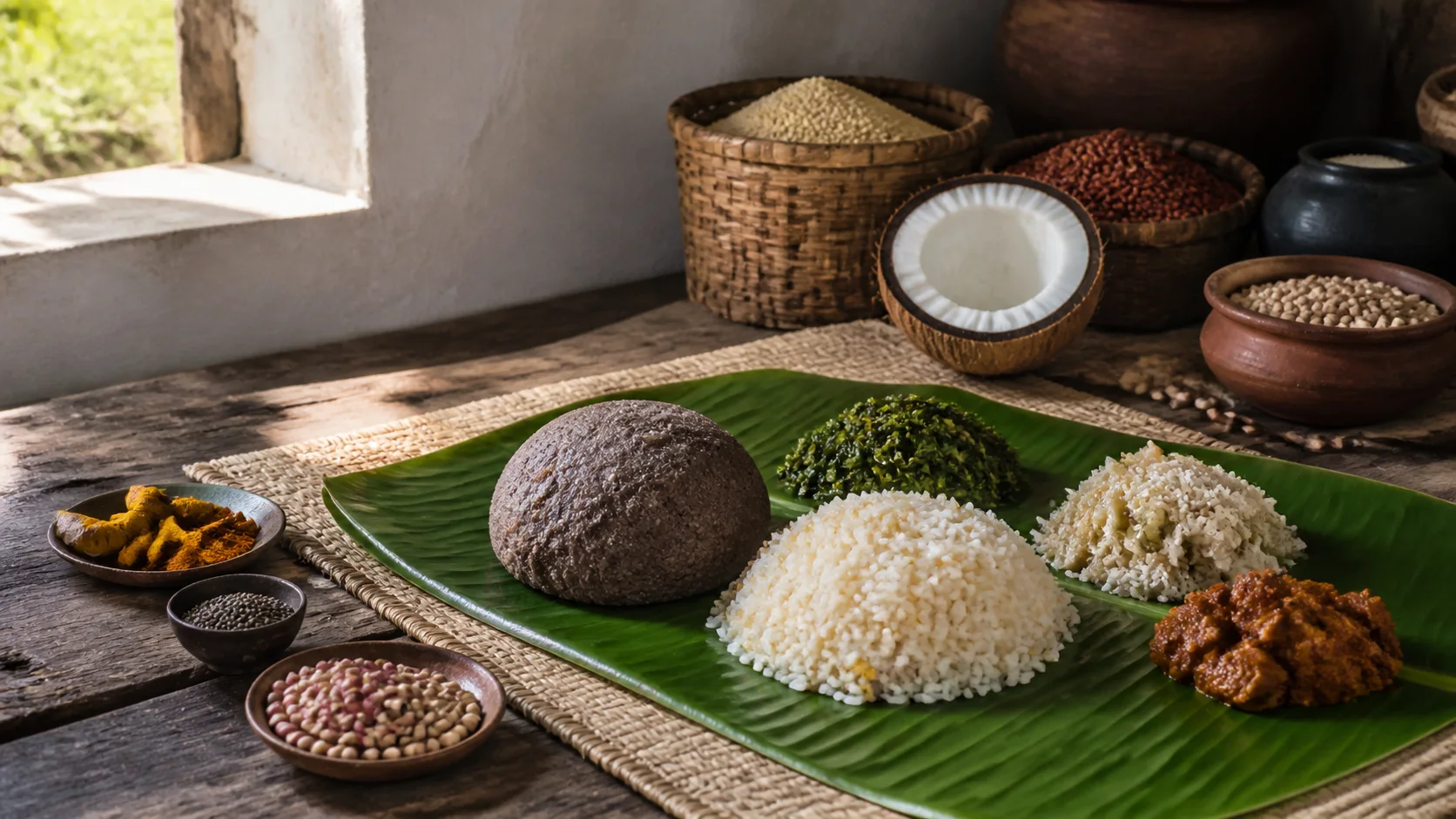
Kongunadu food traditions often foreground millets, rice, pulses, vegetables, coconut, sesame, groundnut and meat in varied household and community practices.
Coimbatore city has a broad restaurant culture influenced by migration and commerce, but no current venue is endorsed.
Pollachi-area agricultural identity supports coconut and market narratives; production and prices change and are not hardcoded.
Ask about ingredients, preparation and dietary suitability rather than assuming one recipe represents the whole Kongu region.
Making and provenance
Regional products and crafts
Coimbatore Wet Grinder is listed in the official GI register. That protected name does not automatically authenticate every appliance sold in the city.[giRegistered]
The district is associated with pumps, motors, engineering goods, textiles and agricultural equipment, but manufacturers and current output change.
Coconut and plantation products are linked with the Pollachi and Valparai sides; ethical purchasing requires maker, estate and supply information.
Craft and industrial tours should occur only with explicit business permission and proper safety arrangements.
Landscape first
Nature and wildlife
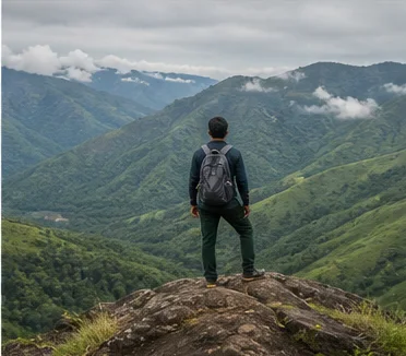
Anaimalai forests, foothills, grasslands, reservoirs and plantation mosaics form ecologically sensitive landscapes connected to larger Western Ghats systems.
Wildlife may cross Valparai and forest-edge roads. Visitors must obey Forest Department controls, speed restrictions and no-stopping directions; sightings are never promised.[forest]
Waterfalls and reservoirs can be closed or dangerous after rain. This page does not convert a named place into guaranteed public access.
The Nilgiris gateway at Mettupalayam leads into another district with separate road, rail and access conditions.
Work and change
Economy and livelihoods
Engineering, textiles, pumps, foundries, information technology, education, healthcare, trade and services make Coimbatore a diversified urban economy.
Agriculture, livestock, markets and agro-processing remain important around Pollachi, Annur, Mettupalayam and other blocks.
Plantations and nature-based visitation operate within environmentally sensitive mountain systems and worker communities.
The guide avoids unstable production rankings, investment numbers and employment statistics.
Build a coherent route
Places to explore in Coimbatore
Coimbatore city
Explore markets, institutions, temples and maker history through permitted public places.
Perur
Connect sacred practice with the western city edge.
Marudamalai
Check road, weather and crowd conditions.
Pollachi
Use the town as a base for careful plain-and-foothill study.
Anaimalai
Separate public town routes from protected-area rules.
Valparai
Plan around road, weather and wildlife safety rather than distance alone.
Mettupalayam
Understand a district town before continuing toward the Nilgiris.
Noyyal and tank context
Use safe public viewpoints and avoid polluted or restricted water edges.
Choose your pace
Things to do
Read an industrial city
Look for work, water and migration behind the maker reputation.
Taste Kongu food with context
Ask how ingredients and recipes vary by community and place.
Spend time in Pollachi town
Balance landscape imagery with markets and everyday settlement.
Drive hill roads responsibly
Follow speed, no-stopping, weather and wildlife instructions.
Visit a living temple
Use current worship and dress information.
Learn product provenance
Verify maker and GI use before buying a named product.
Treat Mettupalayam as a place
Do not use the town only as a transit label.
Keep a weather alternative
Valparai and plains conditions may diverge on the same day.
Conditions, not promises
Best season and current checks
The Palakkad Gap, plains, foothills and high ranges create major local differences; one month label cannot describe the entire district.
Rain and wind can change ghat-road visibility and waterfall safety. Use IMD warnings and district or police advisories.[imd][warnings]
Plantation appearance, reservoir levels and wildlife movement are not guaranteed visitor products.
City activities provide useful alternatives when mountain access is unsuitable, though current venue information still needs checking.
Plan by days
Suggested duration
1 day
Choose Coimbatore city or Pollachi as one focused introduction.
2 days
Pair city history and food with a separate Pollachi or Mettupalayam context.
3 days+
Add Valparai only with a dedicated condition-led hill plan and realistic road margins.
Regional access
How to reach
Rail
Coimbatore and Mettupalayam serve different rail corridors; consult Indian Railways for current services.
Road
Major routes cross the plains and ghats, but hill travel times and closures are not hardcoded.
Air
Coimbatore airport serves the region; confirm current operations directly.
Mountain rail connection
Nilgiri Mountain Railway services begin from the Mettupalayam context; tickets and operations require official verification.
Local movement
Getting around
City buses and local vehicles suit urban travel, while Pollachi, Mettupalayam and Valparai need separate route plans.
Map distance is a poor guide on ghat roads. Weather, wildlife movement, traffic and road work can change a journey.
Never stop on a forest road merely for a photograph or animal sighting; follow posted and official instructions.
Place-name links
Map of Coimbatore district
No fabricated coordinates or heavy map embed are used.Map data is not embedded on this lightweight page. Open a place-name search in Google Maps for current roads, business details and directions.
Continue geographically
Nearby districts
Continue by subject
Related My Tamil Nadu guides
Practical planning
Save a district checklist
Saved only in this browser. No login or personal data is needed.
Questions
Frequently asked questions about Coimbatore
Is Pollachi in Coimbatore district?
Yes. Pollachi and Anaimalai are within current Coimbatore district.
Is Valparai in Coimbatore district?
Yes, but its ghat roads, weather and forest context require a dedicated plan.
Are Tiruppur and Erode part of Coimbatore district?
No. They are separate modern districts despite strong Kongu and economic connections.
Are wildlife sightings guaranteed?
No. Follow Forest Department rules and never stop or crowd animals.
Is the Coimbatore Wet Grinder a registered GI?
Yes. The official register lists it, but individual product claims still need evidence.
Can I visit waterfalls after rain?
Do not assume access or safety; closures and hazards require current official information.
How long should I stay?
Two days introduce city and plains; add more only for a separately planned mountain route.
Editorial trust
Sources and further reading
Major factual claims were checked against authoritative references. Last reviewed 9 August 2026.- About Coimbatore districtCoimbatore District Administration · Official district profileReviewed 9 August 2026
- History of Coimbatore districtCoimbatore District Administration · Official district historyReviewed 9 August 2026
- Revenue administrationCoimbatore District Administration · Official administrative recordReviewed 9 August 2026
- Tourist placesCoimbatore District Administration · Official district visitor recordReviewed 9 August 2026
- How to reachCoimbatore District Administration · Official district transport recordReviewed 9 August 2026
- Registered Geographical Indications in IndiaIntellectual Property India · Official GI registerReviewed 9 August 2026
- Forest and wildlife informationTamil Nadu Forest Department · State governmentReviewed 9 August 2026
- Regional Meteorological Centre ChennaiIndia Meteorological Department · Official weather authorityReviewed 9 August 2026
- Tamil Nadu and Puducherry warningsIndia Meteorological Department · Official warning serviceReviewed 9 August 2026
- National Train Enquiry SystemIndian Railways · Official transportReviewed 9 August 2026