Landscapes, ecology and responsible discovery
Nature of Tamil Nadu
Read Tamil Nadu as a connected environmental system, from high shola-grassland mosaics and deciduous forests to wetlands, waterfalls, dunes, islands and shallow marine habitats.
Statewide nature discovery
Find a landscape, habitat or nature context
Browse reviewed starting points without turning wildlife into a sighting promise or a protected landscape into an access guarantee. Every result continues into an existing guide.
- Reviewed records
- 37
- Nature types
- 8
- Mapped references
- 15
Curated collection
Search across Tamil Nadu's natural environments
Filters change only this page and create no indexable URL state. Map links appear only where Phase 21A already contains a reviewed public location or gateway.
Western Ghats in Tamil Nadu
A mountain system read through rainfall gradients, watersheds, forest mosaics and specific UNESCO serial components rather than one destination label.
Western Tamil Nadu
Nilgiris Upland Landscape
Northern Western Ghats uplands where shola-grassland, forests, settlements and protected landscapes form a connected regional context.
The Nilgiris
Verified context: Within the wider Nilgiri Biosphere Reserve context
Anamalai Hills
A southern Western Ghats hill system of steep terrain, forests, watersheds, cultivated uplands and protected-area contexts.
Coimbatore and Tiruppur context
Palani Hills
An eastern spur of the Western Ghats whose upper landscapes include Kodaikanal, forest, grassland and watershed contexts.
Dindigul and Theni context
Southern Western Ghats Context
Southern highland and catchment contexts that connect forests, rainfall, rivers, waterfalls and the far-southern plains and coast.
Tenkasi, Tirunelveli and Kanniyakumari
Udhagamandalam (Ooty)
An established Nilgiris hill town best understood within a wider upland landscape rather than as a generic cool-weather destination.
The Nilgiris
Coonoor
A Nilgiris hill-town context connected to slopes, rail heritage, cultivated landscapes and regional weather variation.
The Nilgiris
Kotagiri
A Nilgiris upland town whose landscape context differs from both Ooty's urban centre and the Mudumalai lowlands.
The Nilgiris
Kodaikanal
A Palani Hills town linked to upland forest, lake, viewpoint and watershed contexts, with current weather and access requiring separate checks.
Dindigul
Yercaud
A Shevaroy Hills destination that belongs to an Eastern Ghats context, not the Western Ghats.
Salem
Yelagiri
An Eastern Ghats hill destination in Tirupathur district, presented without assuming permanent trail or activity access.
Tirupathur
Valparai Upland Context
An Anamalai upland town and cultivated landscape where forest edges, roads and wildlife movement require careful travel behaviour.
Coimbatore
Shola-Grassland Mosaic
Interdependent patches of montane evergreen forest and grassland that support water, soil and specialized upland habitat.
Higher Western Ghats
Evergreen and Semi-Evergreen Forest Context
Moist forest formations whose distribution changes with elevation, rainfall, exposure and disturbance.
Moist Western Ghats slopes
Deciduous Forest Mosaic
Moist and dry deciduous formations understood as habitat and watershed systems rather than guaranteed wildlife-viewing locations.
Western Ghats foothills and interior contexts
Mangrove and Estuarine Forest Context
Coastal woody vegetation connected with tidal water, sediment, fisheries and wider wetland systems.
Tamil Nadu coast
Mudumalai Tiger Reserve
A protected Nilgiris landscape connected ecologically beyond district and state boundaries; wildlife presence never guarantees a sighting.
The Nilgiris
Verified context: Tiger Reserve
Anamalai Tiger Reserve
A protected Anamalai landscape approached through official visitor systems and habitat context rather than promised animal encounters.
Coimbatore and Tiruppur context
Verified context: Tiger Reserve
Nilgiri Biosphere Reserve Context
A transboundary biosphere-reserve context linking habitats and communities across parts of Tamil Nadu, Kerala and Karnataka.
The Nilgiris and adjoining Western Ghats
Verified context: UNESCO Biosphere Reserve
Wildlife Habitats of Tamil Nadu
A habitat-first overview spanning forest, grassland, scrub, wetland and marine settings without publishing sensitive locations.
Statewide
Vedanthangal Bird Sanctuary
A protected tank and bird-sanctuary context whose Ramsar designation is documented separately; water and bird presence vary.
Chengalpattu
Verified context: Bird Sanctuary and Ramsar Site
Pallikaranai Marsh Reserve Forest
An urban marsh and Reserve Forest with documented Ramsar status, understood as a living wetland rather than a sighting checklist.
Chennai
Verified context: Reserve Forest and Ramsar Site
Point Calimere Wildlife and Bird Sanctuary
A coastal wetland and sanctuary context with official Ramsar documentation; observation must remain within permitted areas.
Nagapattinam
Verified context: Wildlife and Bird Sanctuary; Ramsar Site
Pulicat Lake and Lagoon Context
A cross-boundary lagoon and coastal wetland context where hydrology, fisheries, settlement and birdlife are connected.
Tiruvallur coastal context
Irrigation Tank Wetlands
Human-shaped water systems that can support agriculture, hydrology and bird habitat, with conditions changing by rainfall and management.
Multiple districts
Chennai Urban Coast
An urban Bay of Bengal shore shaped by settlement, rivers, infrastructure, public space and changing sea conditions.
Chennai
Mahabalipuram Heritage Coast
A coastal heritage setting where monument visiting and shore conditions require separate forms of planning.
Chengalpattu
Rameswaram Island Coast
A low island landscape between Palk Bay and Gulf of Mannar contexts where wind, sea and access conditions require current checks.
Ramanathapuram
Kanniyakumari Coast
A far-southern rocky and sandy coastal context whose exposed seafront conditions should be checked close to travel.
Kanniyakumari
Deltaic and Estuarine Coast
A shifting coastal context of river mouths, sediment, wetlands, fishing livelihoods and exposure to weather.
Cauvery delta and adjoining coast
Gulf of Mannar
A marine landscape of shallow waters, islands, seagrass and reef habitats whose geographic and protected-area terms must remain distinct.
Ramanathapuram and Thoothukudi coast
Verified context: Includes Marine National Park and Biosphere Reserve contexts
Palk Bay Context
A shallow coastal-water context north of Rameswaram that is geographically distinct from the Gulf of Mannar.
Ramanathapuram coast
Seagrass and Reef Habitat Context
Shallow marine habitats presented without sensitive wildlife coordinates, access assumptions or promised encounters.
Gulf of Mannar
Courtallam Waterfall Landscape
A Western Ghats catchment and waterfall context whose flow, access and safety depend on recent conditions and official instructions.
Tenkasi
Hogenakkal and the Kaveri
A Kaveri river and falls landscape that requires current district guidance rather than permanent assumptions about water or access.
Dharmapuri
Suruli Falls Context
A Theni district waterfall associated with a Western Ghats catchment; recent rainfall and local controls remain decisive.
Theni
Silver Cascade Context
A roadside waterfall context near Kodaikanal where stopping, flow and access should never be assumed from an older travel account.
Dindigul
No exact matches found
Try another regional name, a broader nature type or clear the map filter.
Continue with purpose
Connect nature with places and planning
Use the specialist system that matches your next question.
Ecological context
Why This Landscape Matters
Tamil Nadu's natural character is not one continuous forest or one climate. The state connects the high western escarpment, interior plateaus and plains, Eastern Ghats hill systems, river basins, tanks and marshes, a long southeast coast, islands and shallow marine habitats. Altitude, monsoon exposure, soils, drainage and land use shape what grows and which animals can use each landscape. The Forest Survey of India's state account describes a wide range of forest groups rather than a single vegetation type.[3]
On this page
Nature guide
Landscapes of Tamil Nadu
Tamil Nadu's natural character is not one continuous forest or one climate. The state connects the high western escarpment, interior plateaus and plains, Eastern Ghats hill systems, river basins, tanks and marshes, a long southeast coast, islands and shallow marine habitats. Altitude, monsoon exposure, soils, drainage and land use shape what grows and which animals can use each landscape. The Forest Survey of India's state account describes a wide range of forest groups rather than a single vegetation type.[3]
A useful nature journey therefore begins with relationships. Shola forest cannot be understood without surrounding montane grassland; a waterfall depends on its catchment and recent rain; a bird sanctuary is part of a larger wetland system; and a beach connects to dunes, estuaries, fishing livelihoods and sea conditions. This hub treats scenery as the visible expression of ecological systems, not as a list of photo stops.
Nature guide
Western Ghats and upland systems
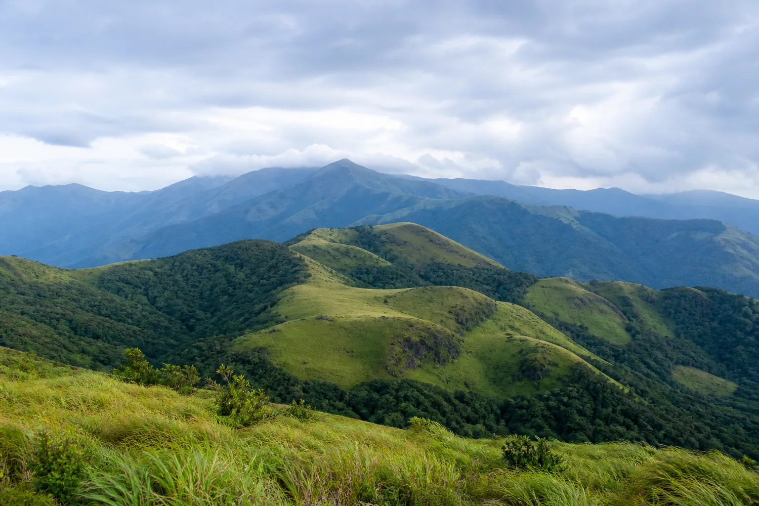
Along Tamil Nadu's west, the Western Ghats include the Nilgiris, Anamalai and Palani hill systems and continue into the far-southern highlands. Rain-bearing winds, elevation and terrain create sharp changes in vegetation over short distances. At high elevations, montane evergreen shola patches and grasslands form a connected mosaic. Lower slopes can carry evergreen, semi-evergreen, moist deciduous, dry deciduous and scrub formations depending on exposure and location.[5]
UNESCO's Western Ghats World Heritage property must be read precisely. It is a serial property of 39 component parts across four states, protected under several legal regimes; it is not a label for every hill, plantation or forest in Tamil Nadu.[4] Tamil Nadu also includes Eastern Ghats contexts such as the Javadi, Kalvarayan and Shevaroy hills. These are separate geographic systems and should not be casually folded into the Western Ghats.
Nature guide
Rivers, catchments and waterfalls
Mountain forests and grasslands intercept rain, hold soil and feed streams. Water then moves through reservoirs, river channels, irrigation systems, wetlands and estuaries before reaching the sea or inland basins. This makes watershed health a practical link between upland conservation and life in towns, farms and coastal settlements. It also explains why a waterfall should not be treated as an isolated attraction detached from rainfall and upstream management.
Courtallam in Tenkasi district lies against the Western Ghats; Hogenakkal is associated with the Kaveri in Dharmapuri district; Suruli Falls is in Theni district and receives water from the Meghamalai range; and Silver Cascade belongs to the Kodaikanal context in Dindigul district.[13][14][15][16] Conditions depend on recent rainfall and local restrictions. No season guarantees flow, access or safe entry into water.
Nature guide
Wetlands and birdlife
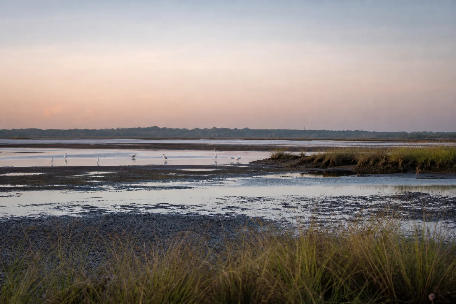
Tamil Nadu's wetlands include natural and human-shaped systems: marshes, estuaries, mudflats, mangroves, river reaches, lakes, irrigation tanks, salt pans and reservoirs. Their value is not limited to birds. Wetlands store and move water, support fisheries and food webs, connect land and coast, and form part of lived agricultural and urban landscapes. The Tamil Nadu State Wetlands Authority maintains the official statewide framework and Ramsar information.[6]
Ramsar Site and Bird Sanctuary are not synonyms. Vedanthangal Bird Sanctuary, Pallikaranai Marsh Reserve Forest and Point Calimere Wildlife and Bird Sanctuary are examples whose Ramsar status is separately documented in official records.[8][9][10] Water levels and bird presence vary with season and year; quiet observation from permitted areas matters more than a sighting checklist.
Nature guide
Coast, beaches and marine ecosystems
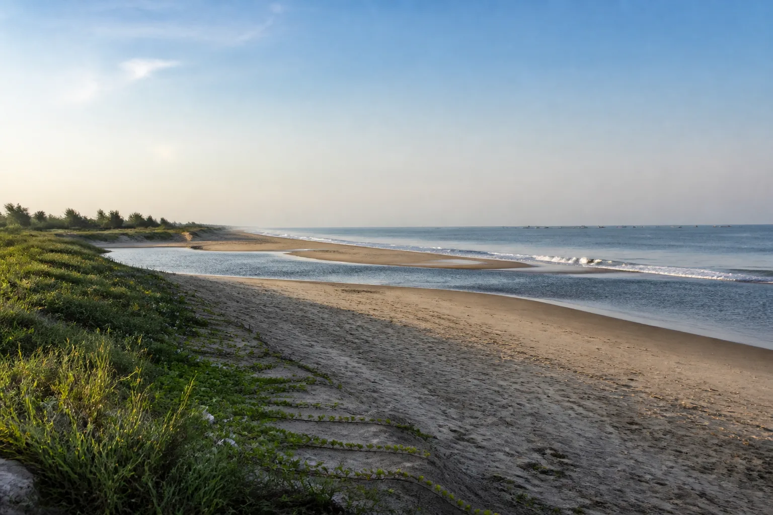
The Bay of Bengal coast is a long environmental edge, not a uniform strip of bathing beaches. Chennai's urban shore, the heritage coast around Mahabalipuram, deltaic and lagoon systems farther south, the island setting of Rameswaram, the Palk Bay margin, the Gulf of Mannar and the far-southern Kanniyakumari coast each have different landforms, livelihoods and exposure to weather. Dunes, estuaries, salt marshes, mangroves and near-shore waters all belong to the coastal story.
The Gulf of Mannar adds reefs, seagrass, islands and a legally protected marine context. The geographic gulf, Gulf of Mannar Marine National Park and Gulf of Mannar Biosphere Reserve are related but not interchangeable terms.[11][12] Sea conditions can change. Follow local safety instructions and current weather or coastal advisories rather than assuming that a familiar-looking beach is safe for swimming.[18]
Nature guide
Wildlife belongs to habitats
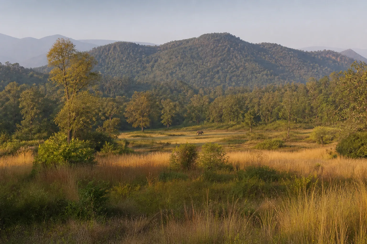
Tamil Nadu supports wildlife across montane grasslands, evergreen and deciduous forests, scrub, river corridors, wetlands, coast and marine habitats. Elephants, tigers, leopards, gaur, deer and primates do not exist as isolated attractions; their survival depends on habitat, water, prey, movement routes and reduced disturbance. The Nilgiri Biosphere Reserve demonstrates how ecological relationships cross district and state boundaries.[5]
Visitors may encounter wildlife, but sightings are never guaranteed. A responsible visit keeps distance, follows ranger instructions, avoids feeding or noise, stays in permitted areas and never blocks a road for a photograph. Binoculars provide a better experience than approaching an animal. Sensitive locations, nests and movement routes are intentionally not mapped here.
Nature guide
Explore nature by district
District guides are the practical bridge between ecological regions and a travel plan. The Nilgiris guide connects Ooty and Mudumalai to the wider Nilgiri landscape. Coimbatore and Tiruppur provide different administrative contexts around the Anamalai region. Tenkasi connects Western Ghats catchments with Courtallam; Dharmapuri places Hogenakkal on the Kaveri; Dindigul frames Kodaikanal and Silver Cascade; Ramanathapuram and Thoothukudi meet the Gulf of Mannar.
Administrative boundaries do not contain entire ecological systems, but they matter for current notices, local authorities and route planning. Use a district guide to understand nearby towns and broad geography, then check the authority responsible for the specific forest, wetland, waterfall or coast you intend to visit.
Nature guide
Nature through the year
Seasonality is regional. Southwest-monsoon exposure is strong in parts of the western highlands while the northeast monsoon is especially important to Tamil Nadu and its coast. Elevation, rain shadow, cyclone influence, local drainage and year-to-year variation prevent a single statewide formula. Conditions vary with rainfall and year; a month label cannot guarantee waterfall flow, bird arrivals, clear viewpoints or forest access.[17]
Use qualitative planning states: strong seasonal interest, good conditions, weather-dependent, rainfall-dependent or extra planning recommended. Then make a current check. Hill roads need weather and visibility review; wetlands need water-level and access context; waterfalls need recent-rain and district notices; coastal travel needs official sea and weather warnings; protected areas need current Forest Department instructions.
Nature guide
Build a nature trip without overloading it
A nature-focused journey works better when it uses one landscape as its main thread. A Nilgiris plan might connect Ooty's established visitor infrastructure with district interpretation and, only when current systems allow, a separate Mudumalai experience. A southern marine plan can connect Rameswaram with Ramanathapuram district context and the Gulf of Mannar guide without assuming island access or boat operation. A waterfall plan should begin with Tenkasi, Dharmapuri, Dindigul or Theni district information rather than a statewide driving circuit.
Limit transfers and leave room for conditions to change. Hills, forests and coasts can all produce slower journeys than a route line suggests. One carefully observed wetland, one interpreted forest edge or one coastal town can be more useful than several rushed map pins. Pair outdoor time with a museum, cultural institution, temple town or regional food context so a closure or weather warning does not force an unsafe substitute.
Different groups need different plans. Families may prefer managed viewpoints, interpretation centres and short established walks. Senior travellers may need seating, shade, reliable toilets and fewer surface changes. Photographers need consent, distance and enough time to avoid blocking others. Accessibility varies by place and cannot be inferred from a landscape category; contact the responsible venue before travel when step-free access, mobility support or other specific facilities are essential.
Google Maps handoffs on these pages identify broad destinations rather than sensitive coordinates. They can help with orientation, but they do not confirm legal entry, road condition, parking, opening, weather or safety. Save the district and authority links alongside the map, check them again close to departure and keep the trip flexible enough to respect a closure.
Nature guide
Why these landscapes matter
Nature protection is not separate from everyday life. Forested catchments influence water and soil; wetlands hold and transform water; dunes and mangroves form part of coastal protection; marine seagrass and reefs support complex food webs; and connected habitats allow animals to move. These functions are reasons to understand visitor limits rather than obstacles to a trip.
Responsible travel is practical: verify access, use permitted paths, carry waste out, keep noise low, give wildlife distance, avoid playback and feeding, never collect coral or shells where restricted, respect community privacy and accept closures. A place can still be meaningful when the experience is observation, interpretation and restraint rather than close access.
Seasonal lens
Nature Through the Year
Conditions vary with rainfall and year. Use the statewide month guides for broad context, then check the responsible authority for current conditions.
Explore Tamil Nadu by Month- Landscape
- Strong seasonal interest
- Conditions
- Weather-dependent
- Planning
- Verify current access
General location only
Open a map handoff
The map opens a broad landscape or visitor destination. It does not reveal nests, dens, breeding areas, restricted islands or sensitive wildlife coordinates.
Private planning tool
Nature Trip Checklist
0 of 10 readySaved only in this browser. No login or personal data is required.
Questions
Frequently asked questions
Is visitor access guaranteed?
No. Protected areas and nature sites can close or change access rules. Check the current Forest Department, district administration or responsible site authority before travelling.
Are wildlife sightings guaranteed?
No. Wildlife is not scheduled and should never be chased. Read these guides as habitat and conservation context, then follow ranger instructions in permitted visitor areas.
Does this page show live weather or road status?
No. This is evergreen ecological and planning information. Use the India Meteorological Department and responsible local authorities for current conditions.
Can I use a drone?
Do not assume that drone use is permitted. Protected areas, coasts and other sensitive sites can have legal and operational restrictions; verify current official rules before carrying or using one.
How should I use Google Maps here?
The map handoff opens a general destination or protected-area search. It deliberately avoids nests, breeding areas, dens, restricted islands and other sensitive wildlife locations.
What natural environments does Tamil Nadu have?
The state includes Western and Eastern Ghats contexts, montane grassland and shola, evergreen and deciduous forests, scrub, river systems, tanks, marshes, mangroves, beaches, dunes, estuaries, islands, seagrass and reef habitats.
Is every Western Ghats landscape a UNESCO site?
No. UNESCO lists a serial property made of specific component parts. The wider Western Ghats are a geographic system, and the two should not be treated as identical.
Media record
Images with explicit provenance
All Phase 10 visuals are project-created editorial interpretations. They support learning and layout but do not document a sighting, current habitat condition or site access.
Editorial trust
Sources & Further Reading
These are the sources actually consulted for this guide. Protected-area, UNESCO, Ramsar, species, habitat and geographic claims are cited inline. Reviewed 9 August 2026.
- Forests, wildlife and conservation in Tamil NaduTamil Nadu Forest Department · 2026Accessed 9 August 2026
- Tiger ReservesTamil Nadu Forest Department · 2026Accessed 9 August 2026
- India State of Forest Report: Tamil NaduForest Survey of India · 2019Accessed 9 August 2026
- Western GhatsUNESCO World Heritage Centre · 2012Accessed 9 August 2026
- Nilgiri Biosphere ReserveUNESCO Man and the Biosphere Programme · 2026Accessed 9 August 2026
- Wetlands of Tamil NaduTamil Nadu State Wetlands Authority · 2026Accessed 9 August 2026
- Ramsar Sites of Tamil NaduTamil Nadu State Wetlands Authority · 2026Accessed 9 August 2026
- Vedanthangal Bird SanctuaryRamsar Sites Information Service · 2022Accessed 9 August 2026
- Pallikaranai Marsh Reserve Forest RISRamsar Sites Information Service · 2022Accessed 9 August 2026
- Point Calimere Wildlife and Bird Sanctuary RISRamsar Sites Information Service · 2002Accessed 9 August 2026
- Biosphere ReservesTamil Nadu Forest Department · 2026Accessed 9 August 2026
- National ParksTamil Nadu Forest Department · 2026Accessed 9 August 2026
- Famous Falls of Tenkasi DistrictTenkasi District Administration · 2026Accessed 9 August 2026
- Hogenakkal Water FallsDharmapuri District Administration · 2026Accessed 9 August 2026
- Suruli FallsTheni District Administration · 2026Accessed 9 August 2026
- Kodaikanal Image Gallery and Silver CascadeDindigul District Administration · 2026Accessed 9 August 2026
- Regional Meteorological Centre ChennaiIndia Meteorological Department · 2026Accessed 9 August 2026
- Coastal Weather BulletinsIndia Meteorological Department · 2026Accessed 9 August 2026